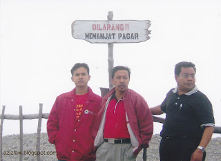
Lihatlah produk pelancongannya, dan kegigihan para penjual pelbagai cenderahati yang ada kaitannya dengan Tangkuban Parahu...
Berada di Indonesia, teringan beberapa lagu Indonesia kegemaran saya, antaranya, CURI-CURI, APA YANG KU CARI, COLEK-COLEK, BURUNG DALAM SANGKAR, CINTA JANGAN DIBELI, CUBIT-CUBIT, MARI BERJOGET, CURAHAN HATI, SEPANJANG JALAN KENANGAN
Di bawah adalah catatan daripada Indonesia Tourism Agency :
Tangkuban perahu is a volcano, 25 kilometers north of Bandung direction of Lembang. Its location is in between Sagalaherang village, Sagalaherang district, Subang regency and Cikole village, Lembang district, Bandung regency. This is Bandung's most famous tourist volcano just 28 km north of the city. This volcano offers many places to see and explore. Whether we look into the huge crater or hike down into it, stroll through the forest on its slopes, or simply enjoy the splendid panoramic scenery. Mt. Tangkuban Perahu is an interesting destination that everyone in the Bandung area is fond of visiting. When seen from Bandung, Mt. Tangkuban Perahu has a distinctive shape, like an upside down boat. Tangkuban Perahu means, in fact, "up-turned boat" This peculiar shape has stimulated the fantasy of the Sundanese people from early times as expressed in the Legend of Sangkuriang. Geologically, Mt. Tangkuban Perahu has played a significant role in the development of Parahyangan highlands. Eruptions have contributed immensely to the hills north of Bandung through lava flowing into the valleys and hardening into rock, thus forming big cliffs over which waterfalls leap. Likewise, mud flows have formed a semi-circular cone of gentle gradient (what geologists call "a fan"), which is now a mass that blocked the valley of the ancient Citarum River near present day in Padalarang (some 18 km west of Bandung), this caused a lake to form covering the whole Bandung plain.


No comments:
Post a Comment
Note: Only a member of this blog may post a comment.